
Floor plans
Everything you need to get started: each floor, dimensioned and annotated
From 3D scan to usable plans in 3 weeks. 2D plans, 3D model and virtual tour included — without disturbing occupants.
A complete set of plans in .DWG, ready to use as a drawing base for all your renovation, permit or regularization projects.
Everything you need to get started: each floor, dimensioned and annotated
Visualise the structure and heights before even visiting
Faithful facades for your permit applications and renovation studies
Precisely locate the building on the plot, boundaries included
Terrain modelled to anticipate placement constraints
Open, draw: files ready to use in AutoCAD and compatible software
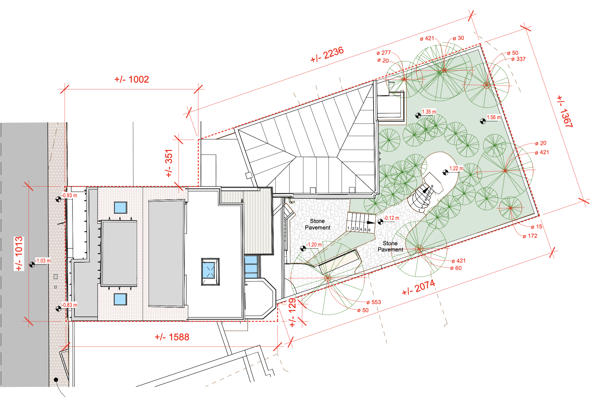
Site plan
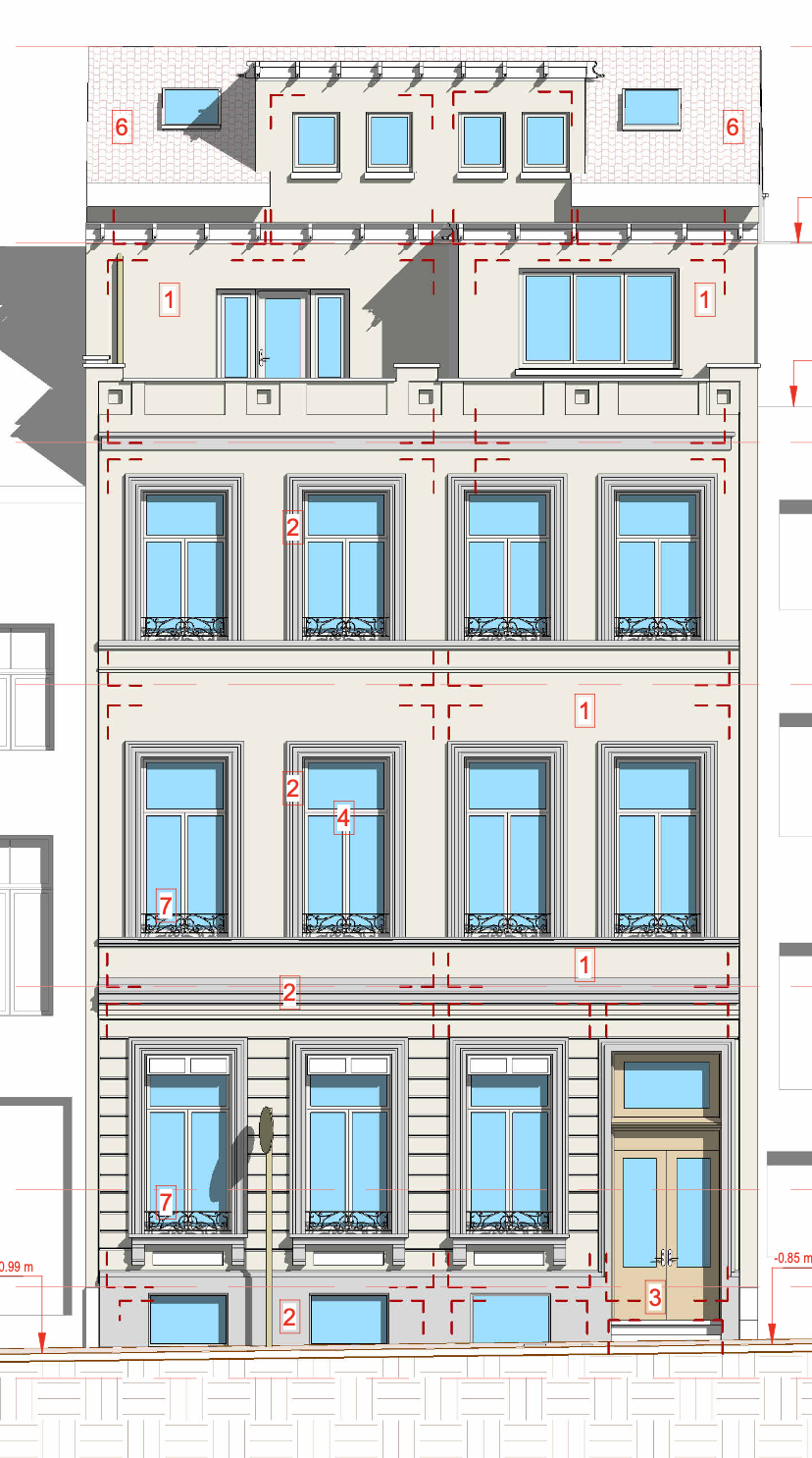
Facade elevation
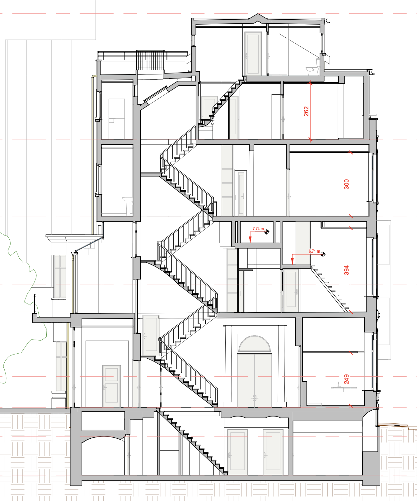
Longitudinal section
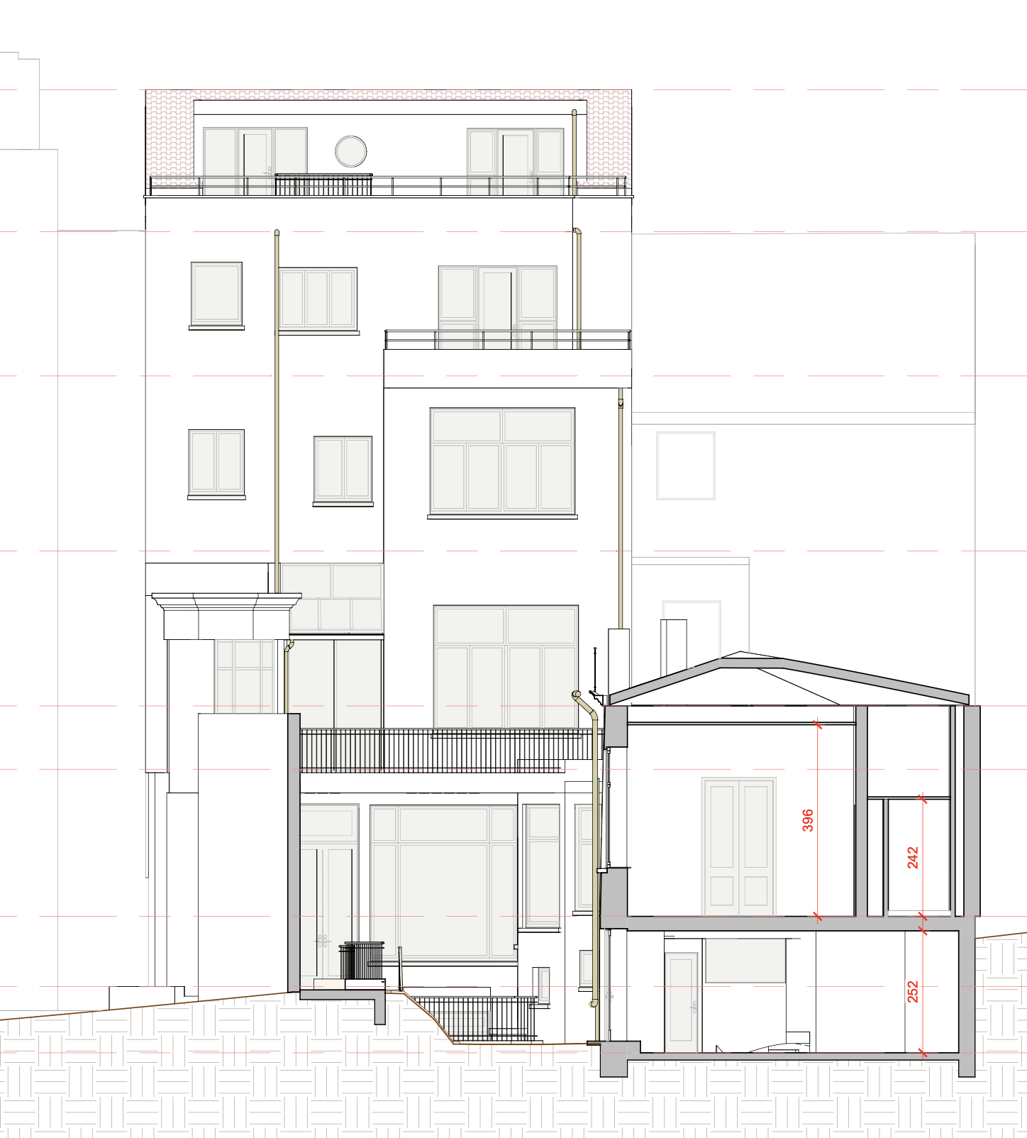
Cross section
Download .DWG samples and test them in your software
Our draughtspeople reproduce the building and its surroundings in a 3D model, with faithful detail thanks to point cloud accuracy.
Work in your environment: Revit, Archicad or Vectorworks
Every detail matters: roof structures, curved walls, complex geometries
Terrain and vegetation included for a complete site vision
Share easily between stakeholders with the open IFC format
Check for yourself: the source point cloud accompanies your model
Explore the building remotely within 48 hours, no installation needed
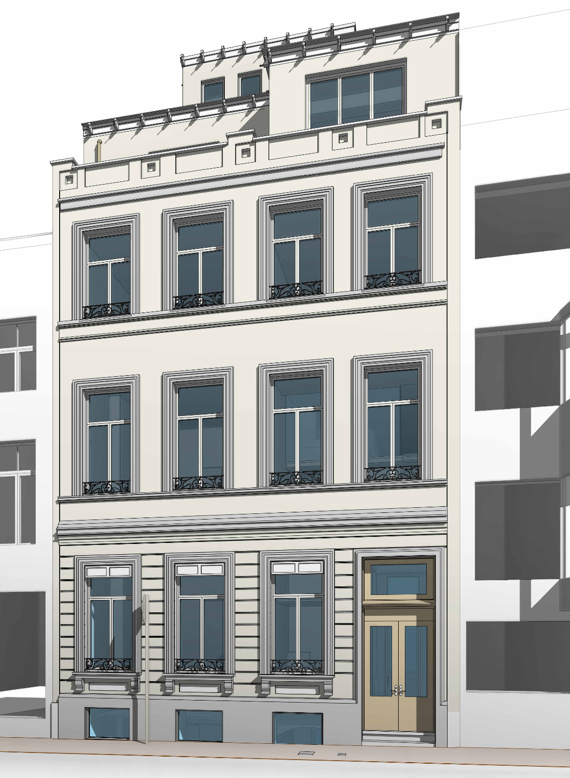
Facade elevation
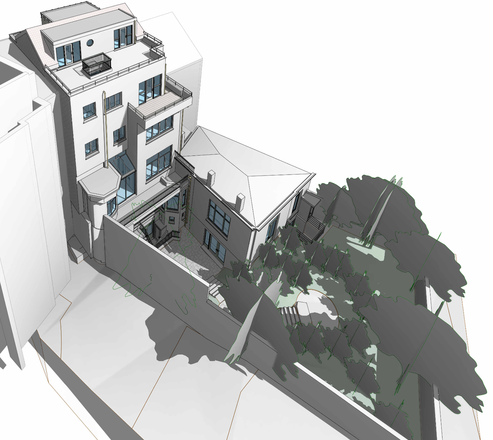
Exterior view
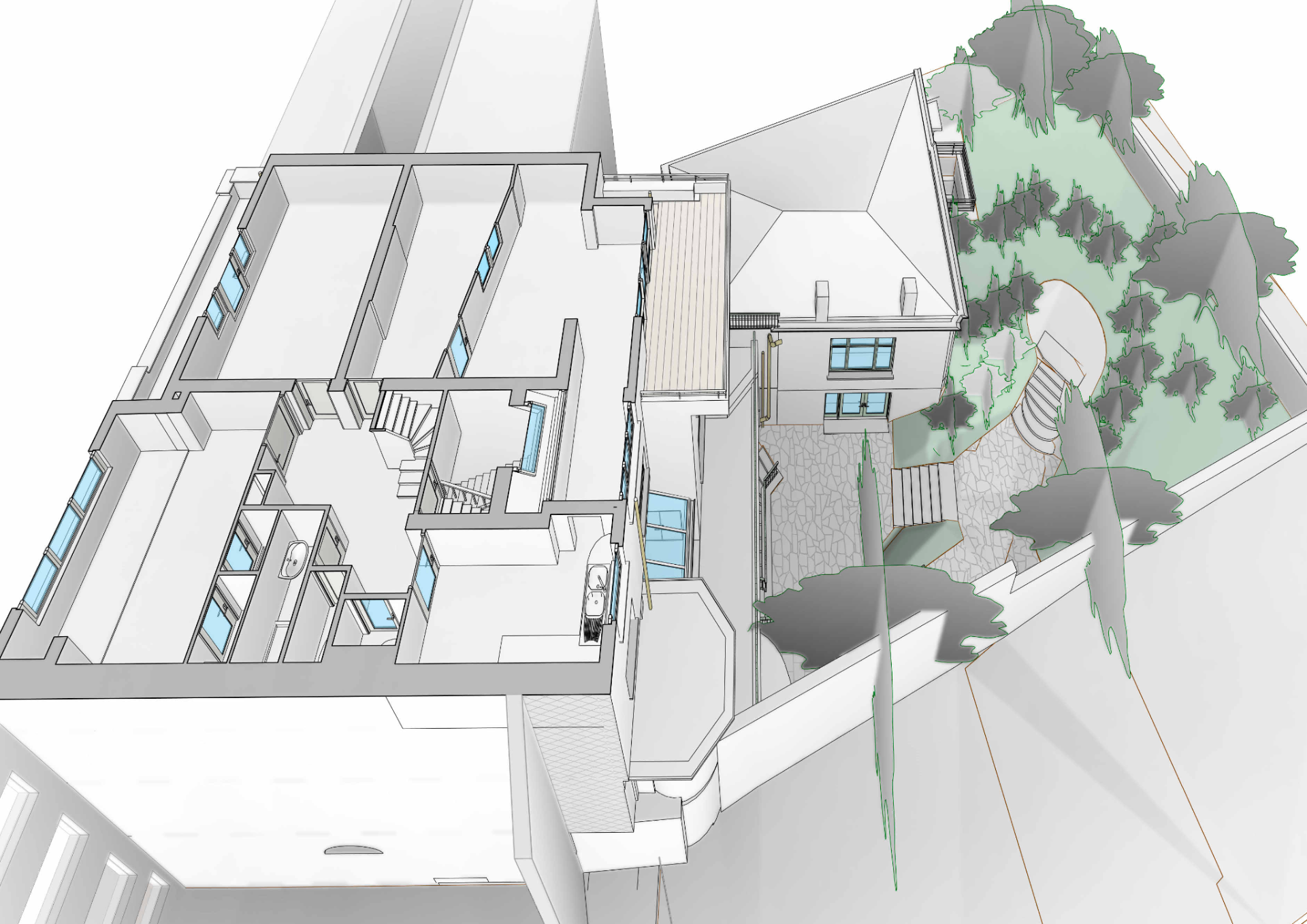
Axonometric view
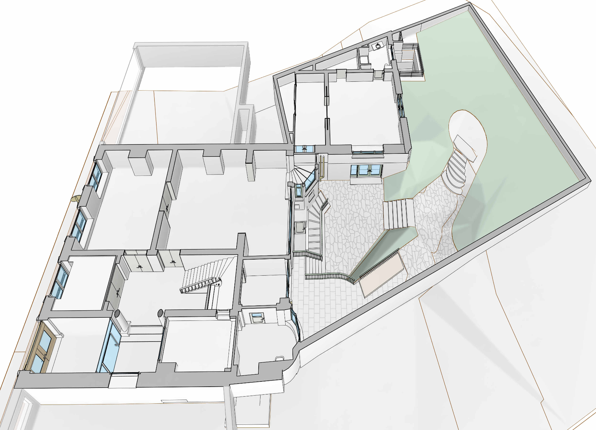
Interior view
Download Revit/IFC samples and open them in your software
Fill in the form in 2 minutes. We'll get back to you within 24 hours with an offer.
We handle everything. Our operator intervenes in one day, without disturbing occupants.
Our architects produce your plans from the scan. You don't need to do anything.
You receive your deliverables within 3 weeks, ready to use.
Each package includes the virtual tour. Choose between the Classic or Premium formula depending on the level of features you need.
DWG, usable polylines
Revit, ArchiCAD, Vectorworks
Does your project require a very high degree of accuracy or specific drawing features?
See the detailed Classic / Premium comparisonExcellent 3D scan of an existing house with a very usable set of plans from VISION by ImmoPass. First-class service. Great added value for the planned renovation works.
Alberick Lismont
4.9 out of 415 verified reviews — Google Review
Every set of plans undergoes a rigorous quality control by an architect, in accordance with best practices, through over sixty verification points applied to your deliverables.
Title, reference, version, scale, date, address — accuracy and readability verified.
3D perspective, axonometry, concise legends and graphic charter compliance.
North arrow, graphic and numerical scales, compliance with standards (1/50, 1/200, 1/500).
Placement of neighbouring buildings, compliance with point cloud.
Property boundaries, access, roads, green areas, main contour lines.
Walls, doors, windows, stairs, guardrails, sanitary installations — completeness verified.
Lintels, cornices, materials, finishes and faithful representation of surface treatments.
Volumetric consistency, level dimensions, floor thicknesses, ceiling heights.
Dimensions, symbols, hatching and legend placement according to internal guide.
A3/A1 template, text readability, DWG/PDF/RVT/IFC exports verified.
Our operator performs a complete building survey with a latest-generation mobile 3D LiDAR scanner. The scan is fast (less than one hour for a house), non-intrusive and allows business continuity during the intervention. Interior and exterior are surveyed in a single visit.
The scanner captures 600,000 points per second with a range of up to 50 metres. The 2D and 3D deliverables, produced from the point cloud, offer centimetre-level accuracy.
After the survey, the building is converted into a high-density colourised point cloud, accessible online without software. You can explore the building, take measurements and visualise surfaces remotely. The tour is available within 48 hours after the scan, with online access included for 12 months (extension possible).
2D plans are delivered in .DWG polyline format, directly usable in AutoCAD and compatible software. The set includes floor plans, sections, elevations, site plans and contour lines.
3D modelling is done directly in Revit, ArchiCAD or Vectorworks according to your preference. Models include high detail of construction elements (roof structure, non-rectilinear walls, etc.) and terrain modelling with contour lines and vegetation.
The Classic formula includes standard plans (walls, partitions, doors, windows, stairs, dimensions, sanitary installations). The Premium formula adds advanced details: sill and lintel levels, wall composition, room names and areas, textures and materials in elevation, transverse and longitudinal profiles, location plan and urban planning context.
All types of buildings, regardless of their complexity or size: residential, commercial, retail, listed heritage, campuses, co-ownerships, steel structures, topographical and landscape surveys. We have completed over 600 projects, from houses to 30,000 m² shopping centres.
Every set of plans undergoes a rigorous quality control by an architect, through over sixty verification points. ImmoPass is ISO 9001:2015 certified, attesting to optimal working methodology. A Quality Certificate is attached to every delivery.
The virtual tour is accessible within 48 hours after the scan. Plans and models are delivered within 3 weeks after the on-site survey. We understand the urgency of certain projects and make every effort to meet these deadlines.
Yes, the point cloud is exportable in .E57 format, an open standard compatible with most point cloud processing and BIM modelling software.
Yes: drone photography (included in both formulas), Lambert 72 geo-referencing as an option, geolocation and boundary surveying, as well as various complementary measurement tools (drone, GPS rod, etc.) depending on the project's needs.

Do you have a specific project or a question about our services? Don't hesitate to contact me directly.
Virginie Riga — Account Manager