
Co-ownership • Brussels
Energy renovation of a building: 3D drone facade scan
How a co-ownership property manager obtained precise measurements of all facades and the roof of a large building — without scaffolding, in half a day.
We needed reliable quotes for the building's insulation, but no company could price it correctly without precise facade plans. Thanks to the drone scan, we received a complete file in two weeks — and the quotes are finally comparable.
Marc Devries
Co-ownership property manager — Brussels
From drone to plans: project timeline
01
The context: energy renovation of a building
With the strengthening of PEB standards in Belgium, a co-ownership property manager needs to plan complete facade insulation of a large Brussels building. Problem: impossible to get reliable quotes without precise facade measurements — and high-level access makes a traditional survey costly and risky.
Without reliable measurements, companies cannot price insulation work correctly.
02
3D drone scan — ½ day on site
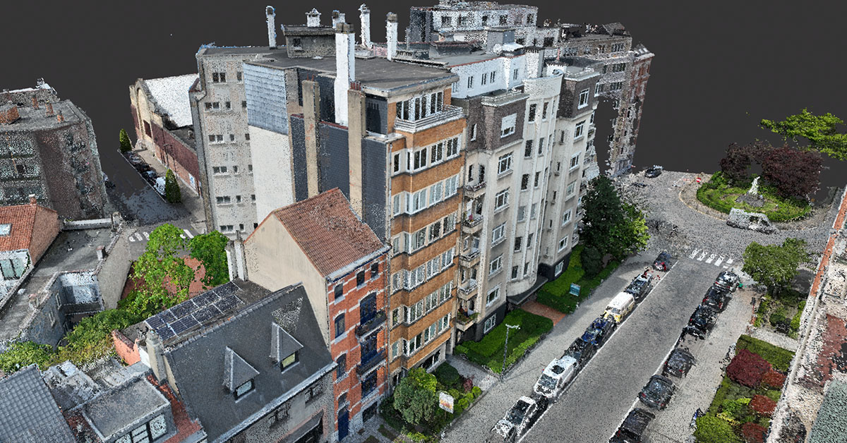
For this type of tall building with difficult access, we opted for a drone survey. Equipped with the required licences and authorisations, our pilot scanned the entire building at 360° — all 4 facades and the roof — in half a day. Aerial photogrammetry offers approximately 1 cm accuracy, without requiring scaffolding or a cherry picker.
No scaffolding, no cherry picker: the drone captures all facades in a few hours.
03
Point cloud and digital twin
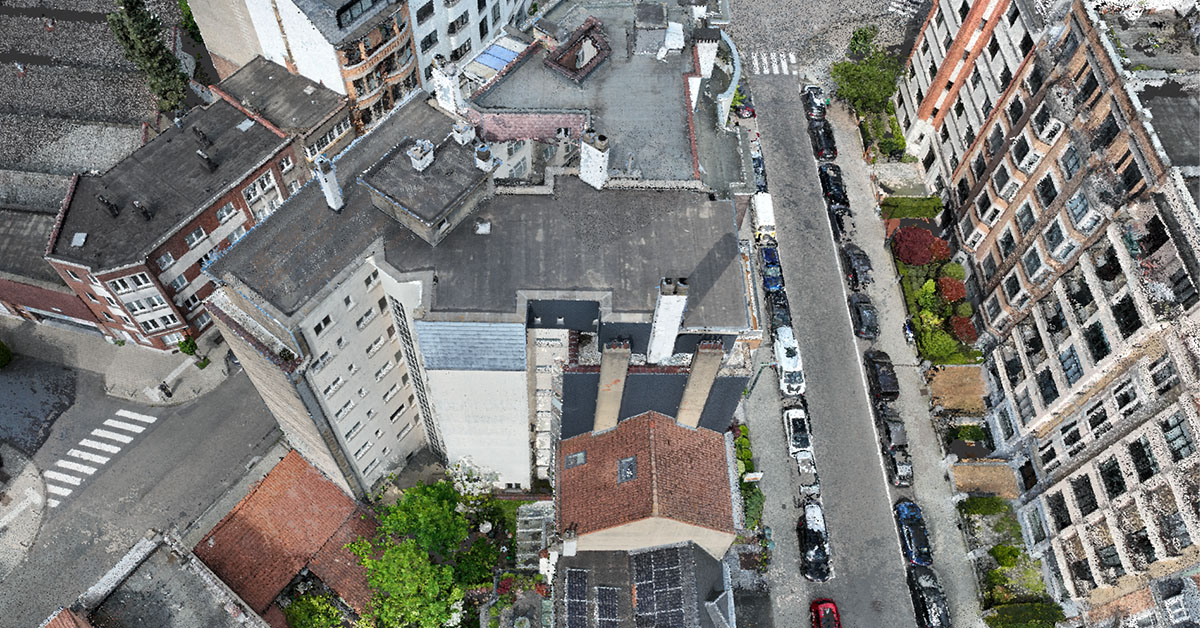
Processing the drone data generates a high-density colourised point cloud of the building's complete envelope. The property manager receives access to the digital twin within 48 hours: they can explore the facades in detail, check dimensions, identify pathologies and share the model with consulted companies — all from their browser.
The property manager and companies consult the same 3D model, without travelling.
04
Facade and roof plans delivered in 2 weeks
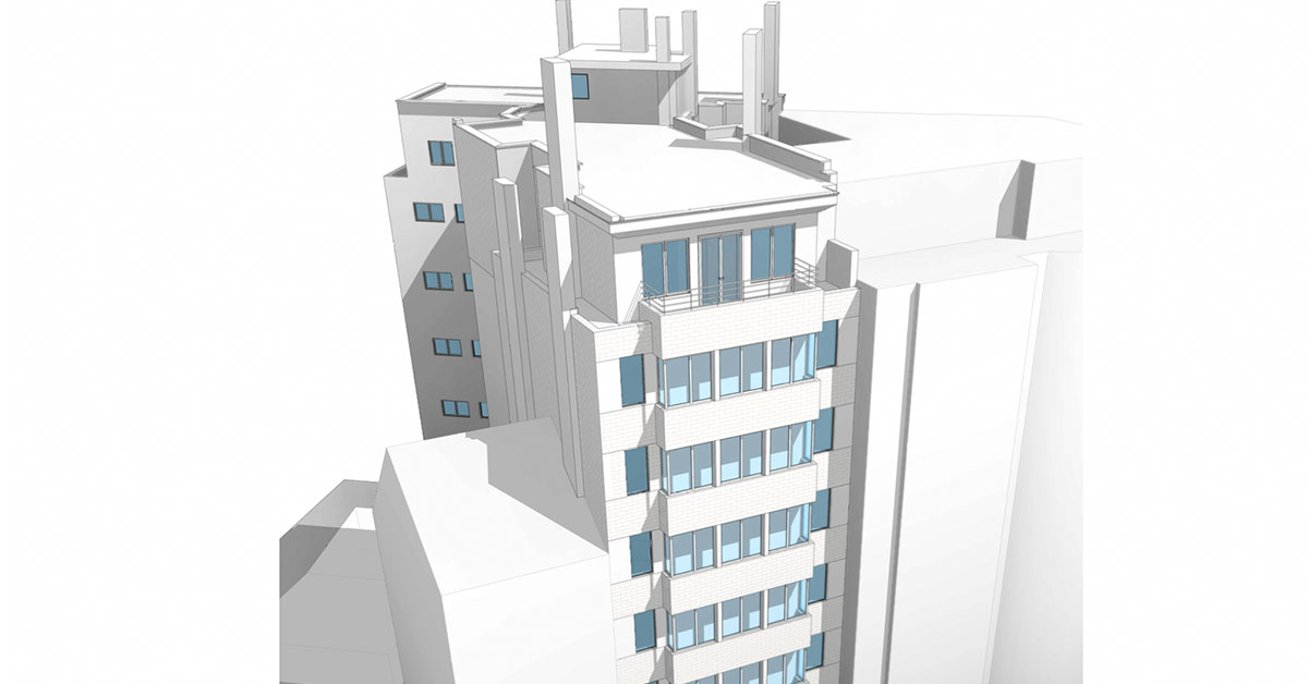
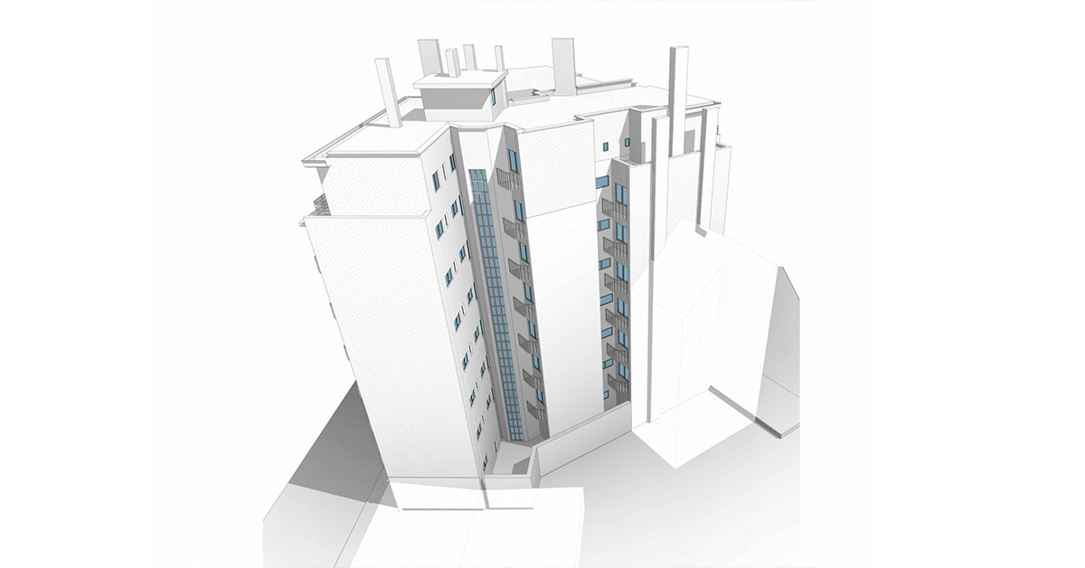
Our draughtspeople model the building in 3D from the point cloud. The delivered file includes detailed elevations of all 4 facades, the roof plan with all technical elements (chimneys, drains, guardrails), and the complete 3D model. All files are provided in DWG and PDF, directly usable for quote requests and planning permission.
Facade plans to the millimetre, ready for quote requests and planning applications.
Why a drone for facades?
Aerial photogrammetry is the ideal solution for tall buildings with complex access.
Aerial photogrammetry
The drone captures hundreds of high-resolution photos from different angles. The software automatically reconstructs the 3D point cloud from these images.
Visual facade diagnosis
The point cloud allows identifying cracks, degradation and potential thermal bridges — a valuable asset for the renovation specification.
Safety and compliance
Our pilots hold all required licences (DGTA) and urban zone flight authorisations. The scan is non-intrusive for occupants.
Multi-format delivery
Plans delivered in DWG, PDF and 3D model — compatible with all professional software. Each file is verified according to our 60+ point quality protocol.
Deliverables: facades, roof and 3D model
Detailed elevations, roof plan and 3D model — delivered in DWG and PDF.
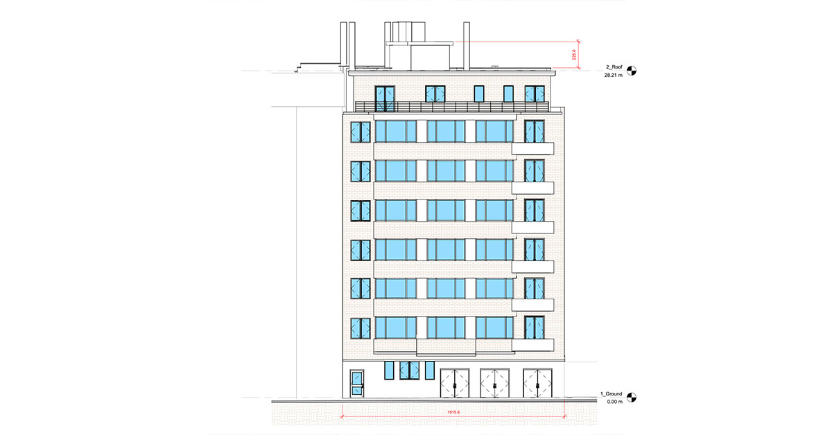
Front facade elevation
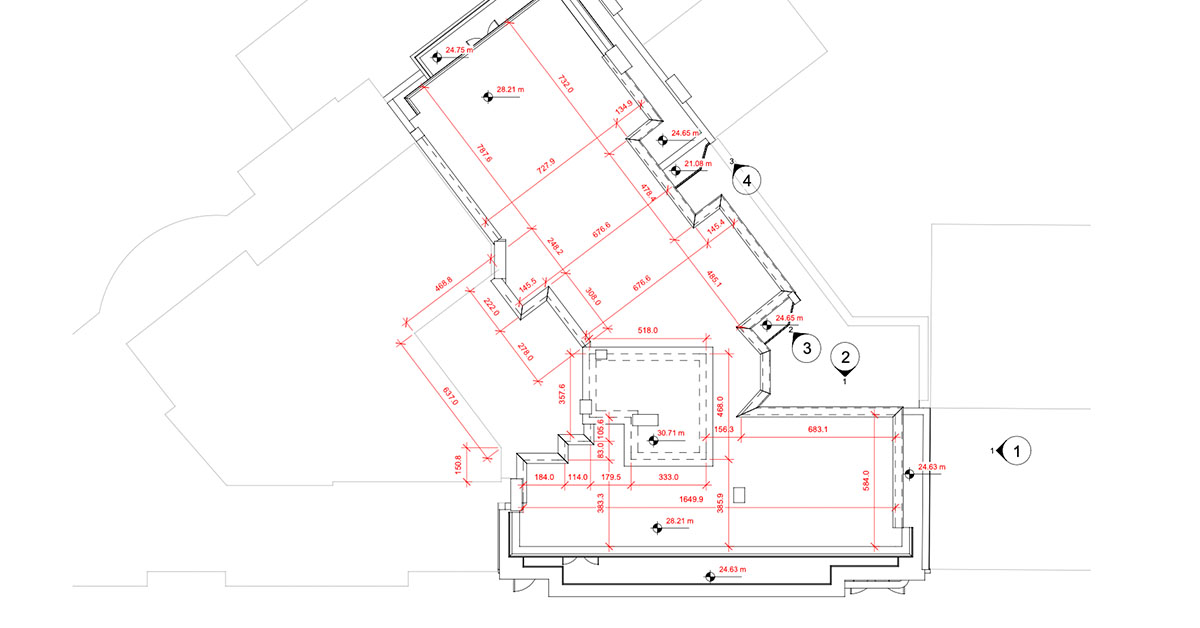
Roof plan
3D model
What the property manager gained
A complete technical file to manage the energy renovation with confidence.
A facade renovation project?
Co-ownership, office building, industrial building — we adapt the technology to your needs.